Streetscape generates map images.
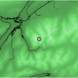
Here is an example of the sort of image Streetscape generates:
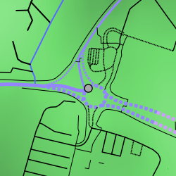
This particular image was generated using the place name "Dalvenie Roundabout, Truro", with extent set to 150 metres, road colour set to "OSM speed limits", and elevation rendering with background smoothing enabled.
But... what does it mean?
Okay, so...
- The place name gets mapped to a set of geographic coordinates using the Geoapify geocoding API
- The generated image is centred on these coordinates; or, if "Adjust to nearest road" is selected (this is the default), the image will be centred around the coordinates of the point on the road nearest to the geocoded coordinates
- The area shown in the image is defined by the extent parameter. In the case of the above image, it's 150 m x 150 m
- The grey dot simply marks the centre of the image. You can also click and drag this dot to a new location on the map; when released, the visualisation will regenerate for that point
- The lines represent roads. Thicker lines represent larger road types (e.g., motorway); dashed lines represent one-way roads
- Line colour denotes speed limit: a blue-red colour gradient is used, from low to high speed limits. See the colour chart below. Black is used where no speed limit data is available
- The darker green areas in the image background represent areas of lower elevation, while the lighter green areas represent areas of higher elevation
When you select "OSM speed limits" as the road colour option, roads are coloured according to their speed limits using this gradient:
| Speed limit | Colour |
|---|---|
| 20 mph | |
| 30 mph | |
| 40 mph | |
| 50 mph | |
| 60 mph | |
| 70 mph |
Additionally, you can opt to generate a "crash risk index" for the visualised location. If selected, the application uses a trained convolutional neural network to predict crash risk based on the generated image, implicitly incorporating features like road layout and elevation. Note that enabling this feature locks several visualisation parameters to specific values required by the model. Read more about the model in Backstory.
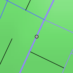
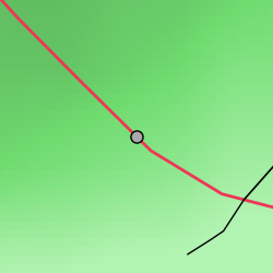
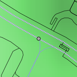
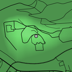
Here are some other random examples of images generated by Streetscape:
The software is capable of rendering both small and large areas, with precise integration of elevation data at any scale:
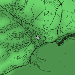
Each of the three images above is a famous place in Britain. See if you can guess any!
Reveal answers
Image 1: Ben Nevis
Image 2: Edinburgh Castle
Image 3: White Cliffs of Dover
I'd like to end by highlighting the performance implications of particular parameter configurations. Increasing the extent value increases the query time exponentially. Elevation rendering and background smoothing have negligible effect when extent is limited, but can become blockers in their own right when extent is high. Including all roads can have an even more deleterious effect on performance given high extent, and this effect is exacerbated if feature extraction is enabled. To protect web server resources, there is a 30-second query timeout in place, and you are very likely to bump up against this if you are not cautious with your parameter adjustments.